Development of innovative methodology for non-destructive assessment and promotion of cultural heritage monuments (Inspire)

Research and pilot application at the Western Necropolis of Ancient Ambracia, in modern Arta.

#
The Project

About the Project

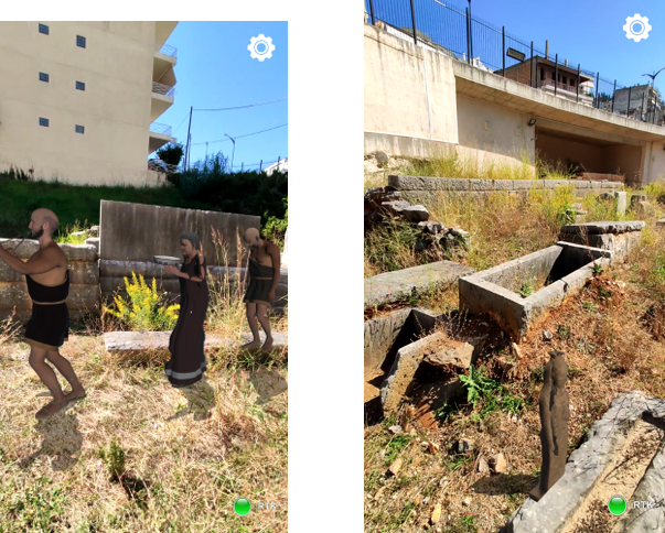
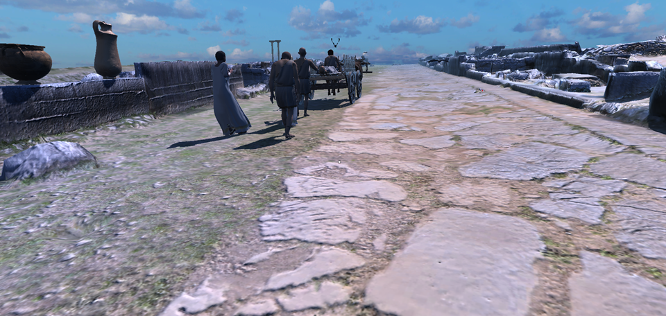
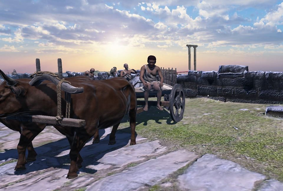
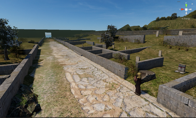
The project involves the study and application of advanced augmented reality technologies (Augmented Reality – AR) in both indoor and outdoor archaeological areas, aiming to visually and acoustically enhance them and, as a secondary goal, to sustain archaeological sites by improving their conservation monitoring process.


For this purpose, the archaeological site will be digitized in 3D, the site's conservation data will be digitized, and a unified database will be created including the digitization files and the results of the non-destructive evaluation of the site using drones.


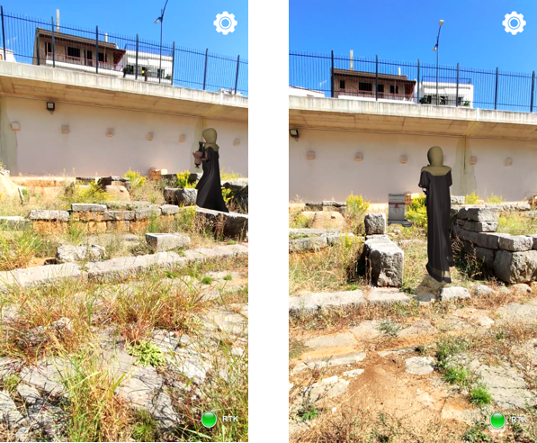
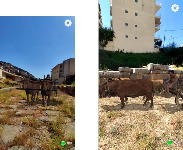
This allows the user to navigate in real-time and see on the screen of a suitable MARS (Mobile Augmented Reality Systems) device the 3D models represented exactly in the position indicated by the cultural management authority (Ephorate of Antiquities of Arta in this specific project).


The effort requires the development of special software so that the models are displayed with minimal deviation in terms of position and scale. Given that this must be done in real time, the software and technology developed will support immediate re-mapping of the models with every minor change in the user's position or head turn, responding within milliseconds.


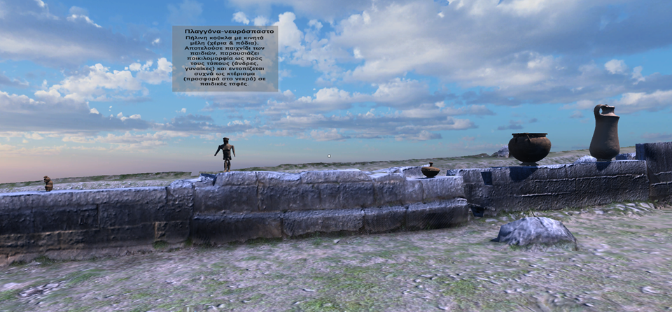
Additionally, in the field of sustainability, an archaeologist or conservator will be able to see information from the conservation file of an ancient object in the area, as long as the device's camera is focused on it. The object will be recognized by the device's camera, and then the related information will be displayed on the screen, enriched with graphics and colors for more efficient visualization (e.g., increasing the contrast at points where additional materials have been incorporated into the object).

Objective

Objective of the Project

The project has the following objectives and will focus on 4 axes:


The first axis aims to explore the best methodology for 3D digitization of both archaeological sites and artifacts, and for the most suitable positioning system methodology for outdoor areas in real-time aiming for a result with zero deviation, low noise, and minimal latency.


The second axis aims to identify the most suitable methodology for virtual tours/storytelling aiming for the best visual and auditory presentation in relation to the position and interests of the visitor, and to develop the best methodology for a common and synchronized augmented reality experience among users, focusing on their simultaneous immersion and interaction with the space.


The third axis aims to develop the most suitable methodology for recording and augmented presentation of conservation data of antiquities to improve the monitoring process of the conservation of archaeological findings.


The fourth axis aims to adapt the virtual reality model to an augmented reality system in the corresponding outdoor reference space, aiming for the best immersion experience of the user in real space and time, and ultimately the pilot application of the system in part of the archaeological site of the Western Necropolis of Ancient Ambracia, to test the proposed innovative augmented reality system under real conditions. The choice of the Western Necropolis of Ancient Ambracia was made because it is a significant and extensive monument and extends along the ancient road, paved on one side, which started from the southern main gate of the wall and led to Amvrakos, the city's port on the Amvrakikos Gulf. This archaeological site will provide the user with a unique augmented reality experience both because of its size and the depiction of artifacts inside the burial monuments, which are now located in the Archaeological Museum of Arta.

Results

Project Results

The installation of the integrated system for navigation in the archaeological site was divided into the following steps: 1) Installation of the central router and connection with access points for full coverage of the site. 2) Installation of an antenna for the Base device. 3) Connection of Base and Rover devices to the local network via Wi-Fi. 4) Setup and connection of the Base device with the installed antenna. 5) Setup and connection of the Rover device with the installed Base device.


The tests conducted in the archaeological site ultimately yielded positive results, however, there were moments when the local network in the site, the augmented navigation application, or the Base-Rover system underperformed. During the tests, observations were made that led to the optimization of the integrated system, with particular emphasis on the following: 1) Optimization of the settings of the entire local network for the smooth interconnection of devices. 2) Optimization of the hardware connections for the integrated system. 3) Better understanding and implementation of the communication of the augmented content application with the Rover device. 4) Exploration of multiple debugging methods for effective problem-solving in the software. Despite the difficulties, the test results after the final preparations showed that a project of this scale is not only feasible but also open to numerous improvements that can be made within the methods of position detection and the development of augmented content software based on these.

Image 2

The AR results were quite good, with accurate positioning of images in space (when there were no temporary network issues).

Image 3 Image 4 Image 5 Image 6

The VR results were also at a very good level of quality and usability.

Image 7 Image 8 Image 1